
Bundle
9
Western Slope/Montrose Area Map Pack
- Backroading
- Camping
- Hiking
- Hunting
- Off-roading
Free
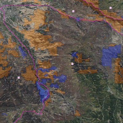
Recreational use map of the Uncompahgre, Montrose, San Juan Mountain areas, Colorado. Public and private lands are displayed by type with BLM as orange, Forest Service as Green and State as Blue. Private is transparent with small indicator rings colored purple. Base map is based on the USGS Satel...
Geographic area:
Category:
Parks & Forests
Size:
1063.82MB
Publication:
November 2022
Language:
English
Map bounds
Maps included in this bundle
This bundle contains 9 maps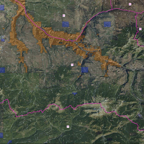
Parks & Forests
Recreational Land Usage - Placerville Area
San Juan Mapping
- Backroading
- Camping
- Hiking
- Hunting
- Off-roading

Parks & Forests
Recreational Land Usage - Lone Cone Area
San Juan Mapping
- Backroading
- Camping
- Hiking
- Hunting
- Off-roading

Parks & Forests
Recreational Land Usage - Nucla/Naturita Area
San Juan Mapping
- Backroading
- Camping
- Hiking
- Hunting
- Off-roading
What you get with Avenza Maps

Reliable mapping tools
Record GPS tracks, add placemarks, add photos, measure distances, and much more.

Locate yourself with GPS
Avenza Maps offline GPS app on your mobile device can locate you on any map, without WiFi or network connectivity.

The best maps by the best publishers
Download professionally curated digital maps on the Avenza Map Store from the best-renowned publishers.