
FREE Colorado Peaks, Views & Parks Map (for passenger cars)
- City Tours
This product can only be purchased in the following bundle(s).
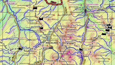
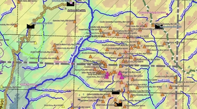
Covering all of Colorado, this basic map focuses on peak names & elevations, scenic views, and parks/other public lands.
Features include museums, picnic areas, scenic views, streams/lakes, highways/main/secondary/local roads, National Forests/Parks/Monuments/Wildlife Areas/Grasslands; ...
Features include museums, picnic areas, scenic views, streams/lakes, highways/main/secondary/local roads, National Forests/Parks/Monuments/Wildlife Areas/Grasslands; ...
Geographic area:
Category:
Roads
Size:
97.34MB
Publication:
November 2022
Language:
English
Map bounds
Check nearby mapsWhat you get with Avenza Maps

Reliable mapping tools
Record GPS tracks, add placemarks, add photos, measure distances, and much more.

Locate yourself with GPS
Avenza Maps offline GPS app on your mobile device can locate you on any map, without WiFi or network connectivity.

The best maps by the best publishers
Download professionally curated digital maps on the Avenza Map Store from the best-renowned publishers.