Tatry Polskie
Free
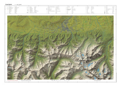
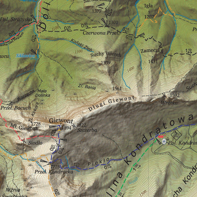
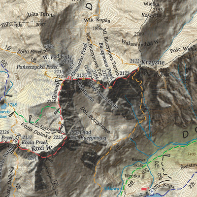
Mapa turystyczna Tatr Polskich. Nowa edycja obejmuje obszar Tatrzańskiego Parku Narodowego. Tatry Wysokie i Zachodnie plus Zakopane i Podtatrze. Nowa metoda 3D przedstawiania rzeźby terenu. Skala mapy 1:25 000. W ofercie również mapy Tatr Wysokich (słowackich) oraz Pienin.
Geographic area:
Category:
Tourist
Size:
36.08MB
Publication:
2014
Language:
Polish
Map bounds
Check nearby mapsWhat you get with Avenza Maps

Reliable mapping tools
Record GPS tracks, add placemarks, add photos, measure distances, and much more.

Locate yourself with GPS
Avenza Maps offline GPS app on your mobile device can locate you on any map, without WiFi or network connectivity.

The best maps by the best publishers
Download professionally curated digital maps on the Avenza Map Store from the best-renowned publishers.