

Tomales Bay Small Boat Chart & Guide
Medeiros Cartography - mapbliss.com
- Camping
- Fishing
- Hiking
- Paddling
$1.99 USD
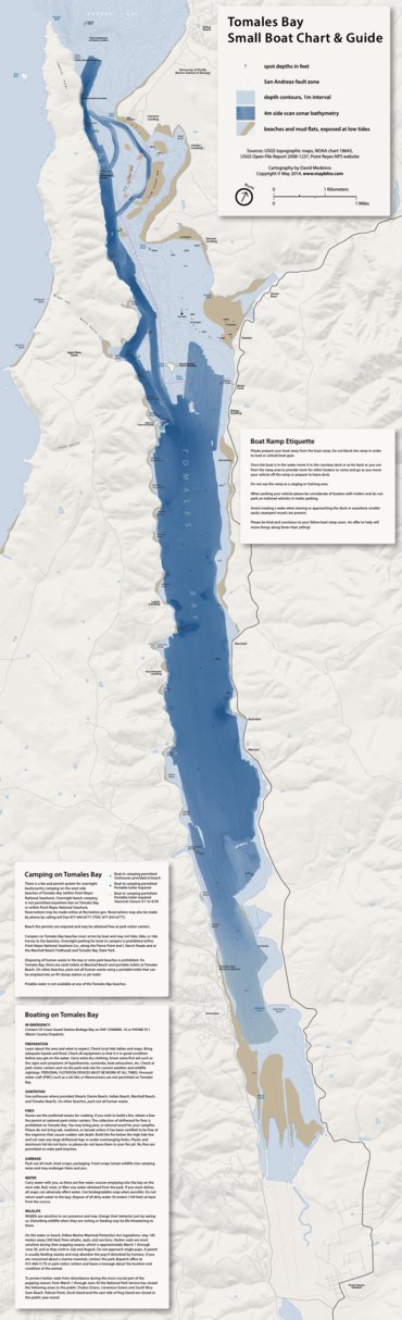
Combines high resolution side scan sonar bathymetry with traditional nautical chart information for a unique and detailed guide to the Tomales Bay.
Users can know the precise depth and appearance of the bottom with out the need for a depth finder.
Perfect for small boat fishing and exploring.
Users can know the precise depth and appearance of the bottom with out the need for a depth finder.
Perfect for small boat fishing and exploring.
Geographic area:
Category:
Parks & Forests
Size:
8.16MB
Publication:
June 2014
Language:
English
Map bounds
Check nearby mapsWhat you get with Avenza Maps

Reliable mapping tools
Record GPS tracks, add placemarks, add photos, measure distances, and much more.

Locate yourself with GPS
Avenza Maps offline GPS app on your mobile device can locate you on any map, without WiFi or network connectivity.

The best maps by the best publishers
Download professionally curated digital maps on the Avenza Map Store from the best-renowned publishers.