3
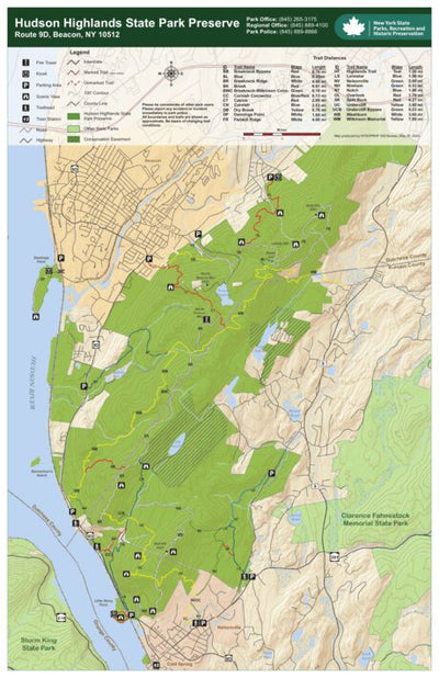
Hudson Highlands State Park Trail Map North
- Camping
- Fishing
- Hiking
Free
A mostly undeveloped preserve of nearly 6,000 acres, Hudson Highlands State Park consists of a series of separate parcels of land stretching from Annsville Creek in Peekskill, north to Dennings Point in Beacon. The spacious park is perfect for outdoor activities such as fishing, boating, hiking, ...
Geographic area:
Category:
Parks & Forests
Size:
9.75MB
Publication:
May 2014
Language:
English
Map bounds
Check nearby maps Customer Reviews
3.3 Based on 3 Reviews
Write a Review Ask a Question - Reviews
- Questions
Filter Reviews:
- benefits
- some
- vistas
- colors
- trailhead
- reference
PR
06/05/2023
Paul R.
I recommend this product
Hudson Highlands State Park Trail Map North
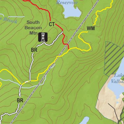
The app is easy to use especially with the benefits of geo referencing. The colors on some of the trails have changed. Cross reference with the map provided at the trailhead. Trails are picturesque with beautiful vistas and well marked. Enjoy!
C
09/24/2021
Customer
The Bronx, New York, United States
Hudson Highlands State Park Trail Map North
C
07/07/2021
Customer
Beacon, New York, United States
Not accurate
Does not show bypass of Sugarlaof mountain wildlife sanctuary
What you get with Avenza Maps

Reliable mapping tools
Record GPS tracks, add placemarks, add photos, measure distances, and much more.

Locate yourself with GPS
Avenza Maps offline GPS app on your mobile device can locate you on any map, without WiFi or network connectivity.

The best maps by the best publishers
Download professionally curated digital maps on the Avenza Map Store from the best-renowned publishers.