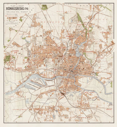
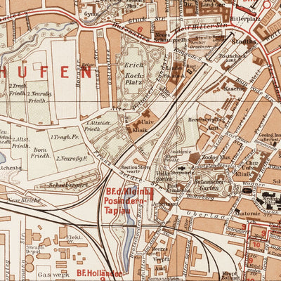
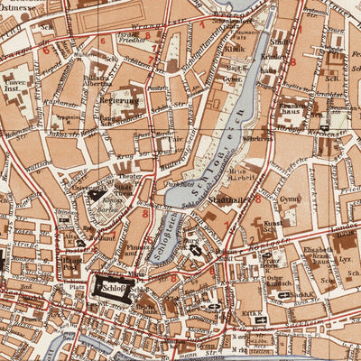
Königsberg (now Kaliningrad) City Map, 1938. Кёнигсберг (Калининград), план города
- City Tours
$2.99 USD
Plan der Stadt Königsberg in Preußen, drawn in 1938. Accurate and detailed map covers entire city area with display of all the streets (fully labelled), public and outstanding buildings, major plants etc. Mass transil lines: tramway and onmibus are given with route numbers, as well as Kleinbahn -...
Geographic area:
Category:
Tourist
Size:
33.32MB
Publication:
1938
Map bounds
Check nearby mapsWhat you get with Avenza Maps

Reliable mapping tools
Record GPS tracks, add placemarks, add photos, measure distances, and much more.

Locate yourself with GPS
Avenza Maps offline GPS app on your mobile device can locate you on any map, without WiFi or network connectivity.

The best maps by the best publishers
Download professionally curated digital maps on the Avenza Map Store from the best-renowned publishers.