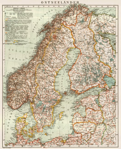
Ostseeländer - the Baltic and Northern Countries General Map, 1929
$2.99 USD
The general map covers in full Estonia, Denmark, Latvia, Lithuania, Norway and Sweden with neighboring areas of the adjacent Germany, Poland and the USSR according to the pre-WWII geopolitical situation. It shows hydrography with main marine waterways and information on depthes, elevations and ra...
Geographic area:
Category:
Historical
Size:
19.68MB
Publication:
1929
Language:
German
Map bounds
Check nearby mapsWhat you get with Avenza Maps

Reliable mapping tools
Record GPS tracks, add placemarks, add photos, measure distances, and much more.

Locate yourself with GPS
Avenza Maps offline GPS app on your mobile device can locate you on any map, without WiFi or network connectivity.

The best maps by the best publishers
Download professionally curated digital maps on the Avenza Map Store from the best-renowned publishers.