

North Carolina Tennessee Cumerberland Blue Ridge 1889
$4.99 USD
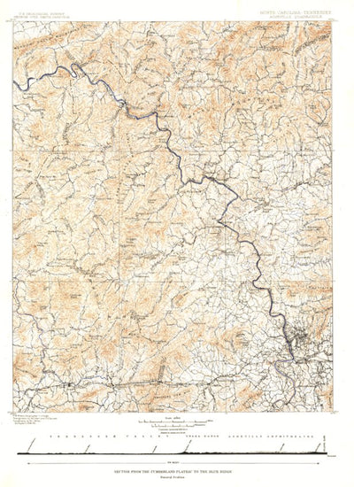
Published in October 1889, the "North Carolina-Tennessee: Asheville Sheet" map shows the area from the Cumberland Plateau to the Blue Ridge Mountains. This intricately drawn map shows the city of Asheville and other towns throughout the region. A unique historical map for collectors.
Geographic area:
Category:
Educational
Size:
27.02MB
Publication:
1889
Language:
English
Map bounds
Check nearby mapsWhat you get with Avenza Maps

Reliable mapping tools
Record GPS tracks, add placemarks, add photos, measure distances, and much more.

Locate yourself with GPS
Avenza Maps offline GPS app on your mobile device can locate you on any map, without WiFi or network connectivity.

The best maps by the best publishers
Download professionally curated digital maps on the Avenza Map Store from the best-renowned publishers.