

Southwestern United States 1959
$4.99 USD
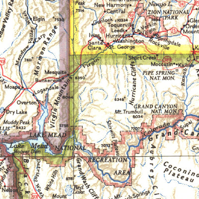
Published in November 1959, the Southwestern United States map features California, Nevada, Utah, Arizona, New Mexico, and Colorado. Insets of the San Francisco Bay Area and the Los Angeles area add detail to these densely populated regions. This is one map in a series of six sectional maps of th...
Geographic area:
Category:
Educational
Size:
40.76MB
Publication:
1959
Language:
English
Map bounds
Check nearby mapsWhat you get with Avenza Maps

Reliable mapping tools
Record GPS tracks, add placemarks, add photos, measure distances, and much more.

Locate yourself with GPS
Avenza Maps offline GPS app on your mobile device can locate you on any map, without WiFi or network connectivity.

The best maps by the best publishers
Download professionally curated digital maps on the Avenza Map Store from the best-renowned publishers.