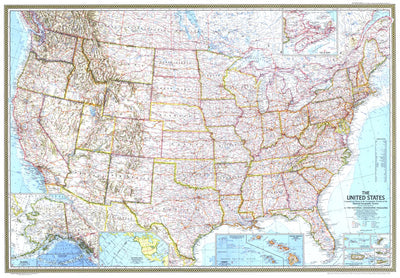
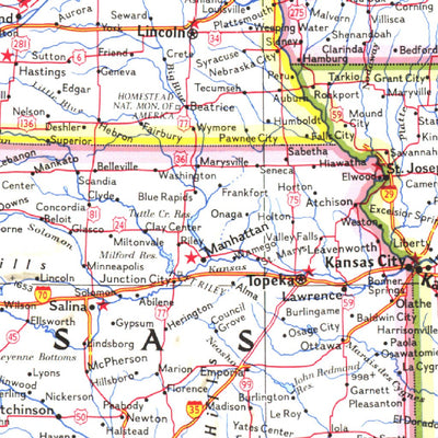
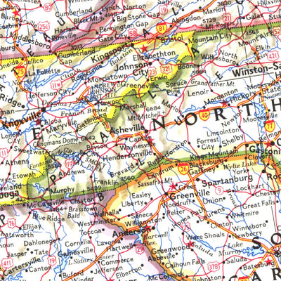
United States 1968
$4.99 USD
This beautiful US map is a historical gem, capturing a snapshot of the country as the Interstate system expanded at a torrid pace. This February 1968 US map featured beautiful cartography--combining many layers of information into an integrated whole that is as artistic as it is informative. The ...
Geographic area:
Category:
Educational
Size:
55.46MB
Publication:
1968
Language:
English
Map bounds
Check nearby mapsWhat you get with Avenza Maps

Reliable mapping tools
Record GPS tracks, add placemarks, add photos, measure distances, and much more.

Locate yourself with GPS
Avenza Maps offline GPS app on your mobile device can locate you on any map, without WiFi or network connectivity.

The best maps by the best publishers
Download professionally curated digital maps on the Avenza Map Store from the best-renowned publishers.