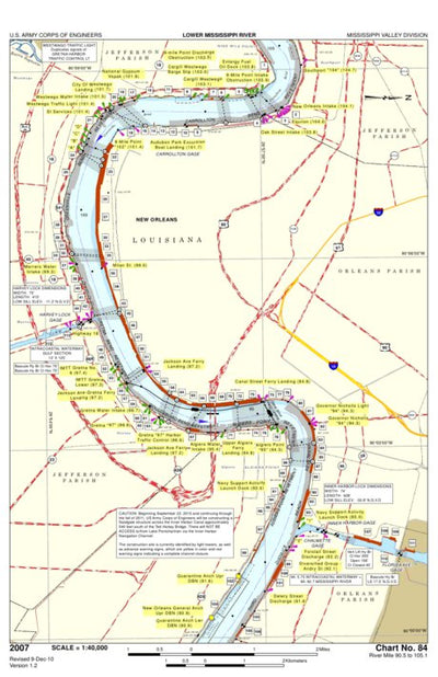


Mississippi River Chart 84, River Mile 90.5 - 105.1
US Army Corps of Engineers - New Orleans
Free
Mississippi River Flood Control and Navigation Charts. This chart no. 84 of 102 covers part of the New Orleans, Louisiana area.
Geographic area:
Category:
Nautical
Size:
2.59MB
Publication:
December 2010
Language:
English
Map bounds
Check nearby mapsWhat you get with Avenza Maps

Reliable mapping tools
Record GPS tracks, add placemarks, add photos, measure distances, and much more.

Locate yourself with GPS
Avenza Maps offline GPS app on your mobile device can locate you on any map, without WiFi or network connectivity.

The best maps by the best publishers
Download professionally curated digital maps on the Avenza Map Store from the best-renowned publishers.