

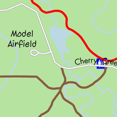
Cherry Creek State Park
- Cycling
- Hiking
Free
A map for cyclists for the State Park southeast of Denver, Colorado, showing in detail the paved and unpaved trails in the park suitable for cyclists, together with the main access points for cyclists. A free supplemental map to ColoradoBikeMaps' Denver Major Metro Trails Map of 2016.
Geographic area:
Category:
Parks & Forests
Size:
1.0MB
Publication:
2016
Language:
English
Map bounds
Check nearby mapsWhat you get with Avenza Maps

Reliable mapping tools
Record GPS tracks, add placemarks, add photos, measure distances, and much more.

Locate yourself with GPS
Avenza Maps offline GPS app on your mobile device can locate you on any map, without WiFi or network connectivity.

The best maps by the best publishers
Download professionally curated digital maps on the Avenza Map Store from the best-renowned publishers.