2
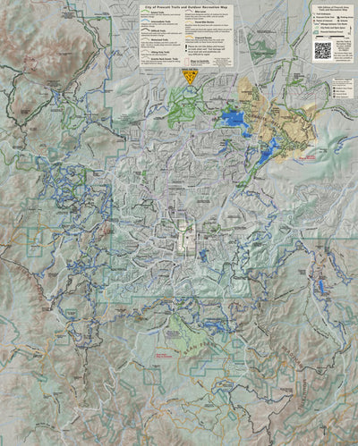
Prescott Trails and Recreation Map
- Cycling
- Hiking
Free
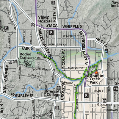
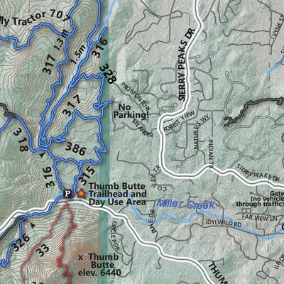
This is the geospatial version of the very popular Trails and Recreation Map. It includes trails, bike lanes and routes, motorized trails, streets, parks and openspace, and other recreational information.
Geographic area:
Category:
Parks & Forests
Size:
56.07MB
Publication:
March 2024
Language:
English
Map bounds
Check nearby maps Customer Reviews
4.5 Based on 2 Reviews
Write a Review Ask a Question - Reviews
- Questions
Filter Reviews:
- Goldwater Lakes
- camping spots
- lots
- phone
- glitches
- trail system
- friends
- route
- area
- trail
A
01/26/2024
Anonymous
I recommend this product
Map use
Downloaded quickly on phone. Used to indicate camping spots for friends. No glitches.
A
12/17/2023
Anonymous
I recommend this product
Avenza worked as guide when trails weren’t well marked.
The map was very helpful when we were hiking in the Goldwater Lakes area recently. There were lots of off-shoot trails, and the trail system is not well marked. We used the map repeatedly to decide which route was the primary trail.
What you get with Avenza Maps

Reliable mapping tools
Record GPS tracks, add placemarks, add photos, measure distances, and much more.

Locate yourself with GPS
Avenza Maps offline GPS app on your mobile device can locate you on any map, without WiFi or network connectivity.

The best maps by the best publishers
Download professionally curated digital maps on the Avenza Map Store from the best-renowned publishers.