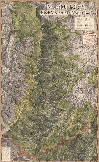


Mount Mitchell and the Black Mountains of North Carolina
- Camping
- Hiking
- Horseback Riding
Free
This free, community-created map covers the Black Mountains of North Carolina, from the Blue Ridge Parkway in the south, to Bowlens Creek in the north.
It includes Mount Mitchell State Park, part of the Pisgah National Forest's Appalachian Ranger District, the Black Mountain Crest Trail, part...
It includes Mount Mitchell State Park, part of the Pisgah National Forest's Appalachian Ranger District, the Black Mountain Crest Trail, part...
Geographic area:
Category:
Trails
Size:
110.55MB
Publication:
January 2022
Language:
English
Map bounds
Check nearby mapsWhat you get with Avenza Maps

Reliable mapping tools
Record GPS tracks, add placemarks, add photos, measure distances, and much more.

Locate yourself with GPS
Avenza Maps offline GPS app on your mobile device can locate you on any map, without WiFi or network connectivity.

The best maps by the best publishers
Download professionally curated digital maps on the Avenza Map Store from the best-renowned publishers.