
Bundle
3
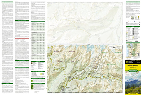
217 :: Mount Rainier National Park
- Camping
- Hiking
- Skiing
$14.99 USD
The highest point in the Cascade Range, Mount Ranier is an icon of Washington state. It is an active volcano and the largest single-peak glacial system in the lower forty-eight states, spawning 6 major rivers. National Geographic’s Trails Illustrated map of Mount Ranier National Park is designed ...
Geographic area:
Category:
Parks & Forests
Size:
122.8MB
Publication:
2019
Language:
English
Map bounds
Maps included in this bundle
This bundle contains 3 maps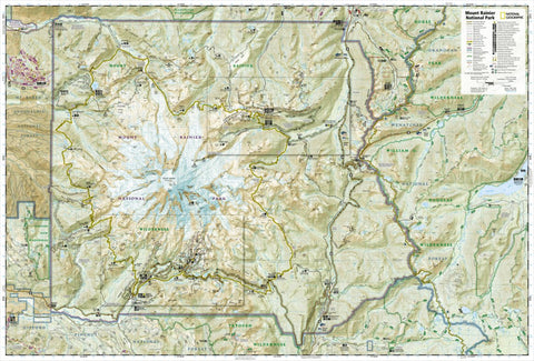

You might also like

4
Parks & Forests
Mount Rainier National Park
US National Park Service · Publication 2017
- Hiking
Free

1
Topographic
Mount Rainier East, WA (2011, 24000-Scale)
United States Geological Survey · Publication 2011
Free

Topographic
Mount Rainier West, WA (2011, 24000-Scale)
United States Geological Survey · Publication 2011
Free

Tourist
Mount Rainier Climbing Routes (Updated 6/15/2023)
Shuksan Geomatics · Publication July 2022
- Camping
- Orienteering
Free
What you get with Avenza Maps

Reliable mapping tools
Record GPS tracks, add placemarks, add photos, measure distances, and much more.

Locate yourself with GPS
Avenza Maps offline GPS app on your mobile device can locate you on any map, without WiFi or network connectivity.

The best maps by the best publishers
Download professionally curated digital maps on the Avenza Map Store from the best-renowned publishers.