Central Skyline Snowmobile Complex
- Off-roading
- Skiing
- Snowmobiling
Free
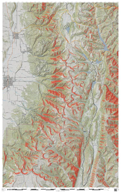
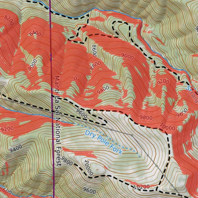
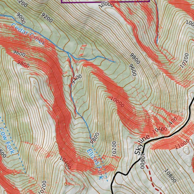
Topographic map of the Manti-La Sal National Forest, east of the towns of Fairview, Mt. Pleasant, and Spring City, Utah. All areas of the backcountry have inherent avalanche risk. This map highlights HIGH-RISK avalanche areas, based on hillside slope (27°-50°) and aspect (300°-150°) only. Extr...
Geographic area:
Category:
Trails
Size:
104.77MB
Publication:
February 2020
Language:
English
Map bounds
Check nearby mapsWhat you get with Avenza Maps

Reliable mapping tools
Record GPS tracks, add placemarks, add photos, measure distances, and much more.

Locate yourself with GPS
Avenza Maps offline GPS app on your mobile device can locate you on any map, without WiFi or network connectivity.

The best maps by the best publishers
Download professionally curated digital maps on the Avenza Map Store from the best-renowned publishers.