10 Years of Avenza Maps - The Top 10 Series (Part 4)

AND HERE'S TO THE NEXT 10!
It’s our final week with this blog series, and we're sad it’s over, but we hope you’ve enjoyed it as much as we have. You can catch up on the other Top 10 blogs here. These final two top tens cover a unique use case and the best features from our desktop cartography software.
Top 10 Patterns Created with Maps
One of the staple features of Avenza Maps is GPS tracking. This feature tracks and marks the path you’ve travelled while recording, generally used to show a route taken. However, some GPS tracking users got a little extra creative. Check out these neat paths and the art they’ve created!
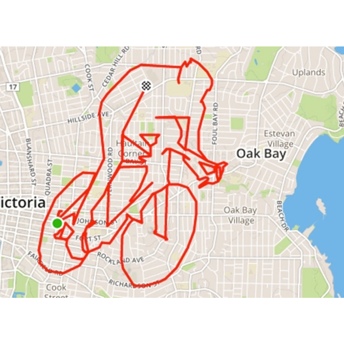
Cycling
A cyclist created this trace of a cyclist, how meta!
Happy New Year
Are you looking to get fit as your new year’s resolution? Try this running path!

Dinosaurs
A larger than life dino spotted by this creative athlete.

Homer
Didn’t know there was a Springfield in the UK?

Giraffe
The detail in this animal art just blows us away, the dedication!

Frida
What do you think the iconic artist would think of this piece?
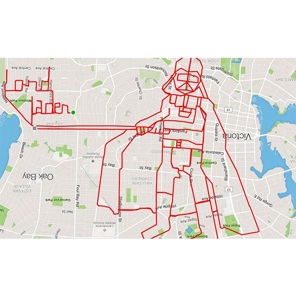
Darth Vader
A visitor from galaxies far far away.
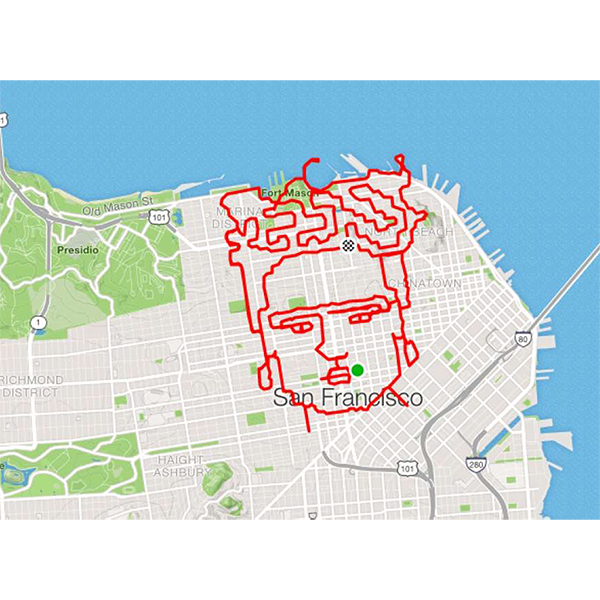
Portrait of a Lady
I’m curious about how many hours it took to create this masterpiece.

Turkey
Happy Thanksgiving San Francisco!

Marry Me, Emily?
Gosh, we hope she said yes!
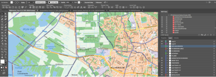
Top 10 Avenza System Tools
If you’re a long time Avenza Maps user, hopefully, you’ve already discovered our incredible desktop cartography tools. Because the heart of Avenza Maps is just that, maps! So make sure to check out MAPublisher and Geographic Imager for ways to create your very own maps. And here are our favourite features
Adobe CC Integration
a) MAPublisher seamlessly integrates into Adobe Illustrator and can be resized, moved, and docked like native Illustrator panels. The MAPublisher Toolbar allows you to quickly launch all the main MAPublisher tools in a single click. Tools are organized to suit your cartographic workflow.
b) Geographic Imager is fully compatible with Adobe Photoshop and provides all its tools and functions quickly and easily. Geospatial information of GeoTIFF, DEM, ECW, MrSID and other supported images are displayed on the panel, including the coordinate system, world location of the corners, and pixel size. Spend more time editing geospatial data rather than searching for tools.
Import and Map Geospatial Data
a) MAPublisher compatible import GIS data formats include ArcGIS, MapInfo, FME Desktop, AutoCAD, Google and other industry-leading formats. Connect to WMS and WFS map services to make importing data even easier. Export the entire document to a georeferenced image, including exporting to web tiles in MapBox and Tile Map Service formats.

b) Geographic Imager allows the use of the Adobe Photoshop native functionality without destroying the spatial properties of spatial images. It allows for easy adjustments to the visual elements such as colour values and levels, histograms, hues and sharpness. Spatial properties of the image are automatically updated and retained even after performing crop, rotate or geospatial adjustments. If you work with georeferenced images in Photoshop, you need Geographic Imager.

Openly View and Edit Data Attributes
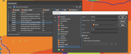
The attribute table gives easy access to map attribute information of your vector lines, areas, or points data. Add and remove columns, edit schemas, join tables, and apply expressions to customize map attributes. You can even pin attributes to keep current even if the artwork is not selected.
Georeference Images Intuitively

Import or add ground control points for accurate georeferencing of aerial photography or satellite imagery. Match real-world coordinates with the aid of online maps. Quick Georeference by a single tie point, two tie points, or from other documents.
Connect to Spatial Databases
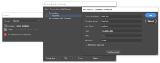
Directly import feature classes from spatial databases like Esri Personal geodatabase (.mdb), File geodatabase (.gdb ) PostGIS, and ArcSDE servers. Use SQL queries and spatial filters to refine import. ArcGIS 10 geodatabases and ArcMap documents are supported.
Advanced Image Format Import
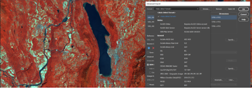
Import multiple files of different formats with drag and drop ability. Resample and crop large images for faster import speeds. You can also mosaic and import images as layers into existing documents.
Create Fresh Styles with MAP Themes

Use MAP Themes to create dot-density maps, charts, and stylesheets for visually stunning maps. Classification methods make it easy to create data classes. Also, create highly customizable MAP Theme Legends that auto-update.
Connect to Web Map Services

Import data directly from Web Map Services (WMS) to deliver raster content in various formats. Select a scale and area to quickly download an image with spatial referencing fully intact.
Import and export elevation data

Import DEM formats such as ArcInfo ASCII Grid, ArcInfo Binary Grid, USGS DEM, Military Elevation Data/DTED, and SRTM. Assign a DEM Schema during import for easier rendering. Overlay aerial photography to create custom looking images. Export to grayscale GeoTIFF and USGS DEM formats.
Thanks For Reading!
We really hope you’ve enjoyed these lists and have learned a few things about maps and Avenza Maps! Make sure to follow us on social to stay in touch about the next blog, news, or updates.