25
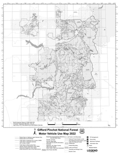
Gifford Pinchot National Forest Motor Vehicle Use Map
US Forest Service R6 Pacific Northwest Region (WA/OR)
- Backroading
- Off-roading
Free
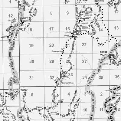
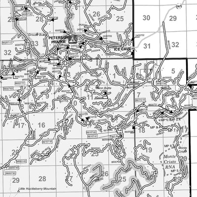
Motor Vehicle Use Maps (MVUM) are the official maps for designating all roads and trails available for public motorized travel on the Gifford Pinchot National Forest. Visitors should not rely on any other map for making decisions about motorized travel.
The MVUMs are free to the public at loca...
The MVUMs are free to the public at loca...
Geographic area:
Category:
Trails
Size:
16.59MB
Publication:
June 2022
Language:
English
Map bounds
Check nearby maps Customer Reviews
4.0 Based on 25 Reviews
Write a Review Ask a Question - Reviews
- Questions
Filter Reviews:
- bones
- criticism
- symbols
- Works
- intersections
- Zoom function
- cell service
- areas
M
10/18/2023
Mcvey
I recommend this product
Just want to be able to plan and ride legally.
The ability to plan a route on the motorcycle only trails was my quest. Not a great map to do that with.
RY
09/02/2023
Randy Y.
I recommend this product
Better than a paper map
Works even without cell service
A
08/31/2023
Anonymous
I recommend this product
excelent map
once I learned how to download the map, I was very happy with this map, It showed me what I needed to see and where I needed to go!
What you get with Avenza Maps

Reliable mapping tools
Record GPS tracks, add placemarks, add photos, measure distances, and much more.

Locate yourself with GPS
Avenza Maps offline GPS app on your mobile device can locate you on any map, without WiFi or network connectivity.

The best maps by the best publishers
Download professionally curated digital maps on the Avenza Map Store from the best-renowned publishers.